Subterranean Saigon: How Ho Chi Minh City Is Unleashing The Frontier Beneath Its Feet
Source: VnExpress
The Depths Beyond the Skyline
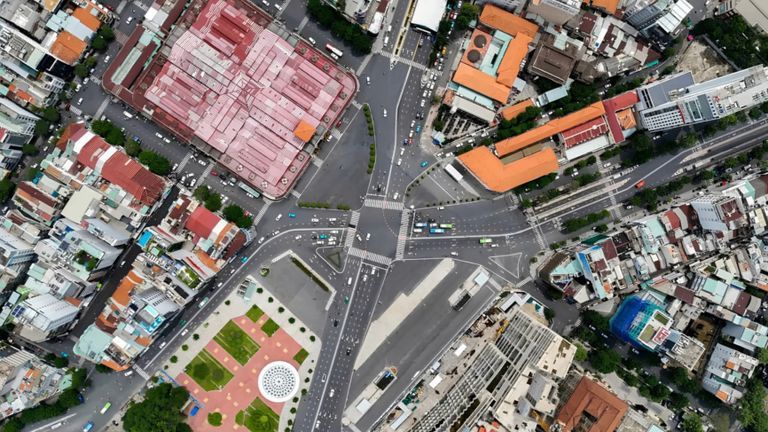
For decades, Ho Chi Minh City has measured its metropolitan ambitions vertically against the tropical sky. From the neoclassical ornament of the French colonial Opera House to the soaring, glass-wrapped monolith of Landmark 81, the southern economic locomotive of Vietnam has consistently signaled its rise through architectural elevation. Yet, step off the sun-scorched pavement of Le Loi Boulevard in central District 1—a historic core recently reorganized under the city's administrative consolidation into the newly established Saigon Ward and Ben Thanh Ward—and you will witness a profound spatial paradox. On the surface, land values have hit astronomical heights—frequently exceeding $20,000 per square meter—rendering downtown land assembly virtually impossible for all but the most capitalized consortiums. Meanwhile, directly beneath the motorbikes, street vendors, and colonial tree canopies sits a vast, unmapped, and fundamentally underutilized urban frontier.
To unlock this buried realm, municipal authorities—leveraging Article 216 of Vietnam's Land Law 2024 and special financial mandates under National Assembly Resolution 98/2023/QH15—have enacted a landmark land-use policy tailored for Metro Line 1's transit-oriented development zones. While Decree 103/2024/ND-CP establishes a baseline national land-rent assessment of 30 percent for underground commercial space, Ho Chi Minh City's specialized policy goes further: granting a 100 percent waiver on commercial land-use fees for underground developments down to a depth of 15 meters. Above that 15-meter threshold—a subterranean zone roughly equivalent to a four-story basement structure—developers can now construct underground shopping arcades, subterranean pedestrian corridors, and transit-adjacent commercial hubs without triggering the exorbitant land-payment obligations that previously doomed underground civil engineering to financial non-viability.
As Metro Line 1 now operates its rapid transit service from Ben Thanh Market to Suoi Tien, city planners are deploying subterranean fee waivers as the primary fiscal engine for Transit-Oriented Development. By incentivizing private developers to dig downward, Ho Chi Minh City aims to convert its sub-surface geography into an interconnected, climate-resilient pedestrian ecosystem.
Unearthing The Asphalt Heritage
To understand why a 15-meter fee waiver carries such transformative weight, one must examine the intricate layers of Saigon’s urban evolution. Historically, the city’s relationship with its soft alluvial soil has been defined by surface-level adaptation. Built upon the low-lying, marshy Delta basin of the Dong Nai and Saigon River systems, colonial urbanists and post-independence planners alike treated the subterranean realm primarily as a domain for utility drainage, foundational piling, and defense bunkers. Culturally, Vietnamese urban life is stubbornly street-oriented. The vibrant economic pulse of the city has long resided in its sidewalk culture where coffee vendors, mobile eateries, and storefront commerce blend seamlessly into a kinetic, open-air public domain. Convincing residents and visitors to retreat underground requires a fundamental shift in daily spatial habits.
However, the rapid hyper-urbanization of the post-Renovation era has pushed this surface-level paradigm to its absolute structural limit. Today, Ho Chi Minh City accommodates over 9 million official residents within its administrative boundaries, alongside millions of registered motorbikes and an exponentially growing fleet of private passenger vehicles. The result is chronic, gridlocked congestion and a drastic deficit of public realm space. Central District 1 possesses a park-to-person ratio that ranks among the lowest of any major Southeast Asian metropolis. Furthermore, the relentless rise of central land values created an urban planning paralysis. When the municipality sought to widen streets or construct public plazas, the cost of land clearance and compensation ate up the vast majority of municipal capital budgets, leaving precious little for civil infrastructure itself.
The emergence of Metro Line 1 radically disrupted this equilibrium. As the subterranean tunnels of the metro system were bored beneath the historic core, connecting Ben Thanh Station through the Municipal Theater and Ba Son, it became obvious that surface stations alone could not handle the foot traffic of a modern transit network. Without a seamless underground pedestrian network connecting transit hubs directly to commercial office towers, hotels, and retail centers, commuters would be dumped directly onto sweltering, flood-prone sidewalks, exacerbating surface chaos rather than relieving it.
Yet, under previous national land regulations, any commercial utilization of underground space was treated with the same punitive valuation metrics as surface land. Developers who contemplated building underground shopping galleries or multi-level subterranean walkways were assessed land-use fees based on the soaring market rate of the plot directly above them. Combined with the massive engineering premiums required to excavate and waterproof deep basements in soft Delta clay, the financial math was prohibitive. The city’s planners realized that if they wanted private capital to build the connective tissue of a subterranean transit metropolis, they had to eliminate the fiscal penalty for digging beneath the surface.
The Architecture Of The Fifteen-Meter Sub-level
The new municipal policy operates with mathematical precision to recalibrate developer return-on-investment models. Under the codified framework, subterranean space is categorized into distinct depth tiers measured from the natural ground surface. The first tier, stretching from 0 down to 15 meters, is completely exempt from commercial land-use fees for public-facing, commercial, and parking developments. For excavations extending deeper into the earth, the municipality applies a progressive, scaled fee structure: space from 15 to 30 meters depth is assessed at a fraction (typically 30%) of the equivalent surface land value, while space beyond 30 meters drops to an even lower assessment rate of 15%.
This 15-meter exemption window was not selected arbitrarily; it aligns precisely with the technical architecture of modern high-density basements. A standard 15-meter excavation accommodates up to four subterranean levels (Level B1 through Level B4). In a typical mixed-use subterranean development around a metro station, Level B1 serves as a climate-controlled retail concourse and pedestrian passage directly linked to the subway turnstiles; Level B2 houses secondary retail and logistics facilities; while Levels B3 and B4 provide mechanical plant space and automated parking infrastructure.
To evaluate the financial impact of this waiver, consider a hypothetical 5,000-square-meter commercial plot in Saigon Ward or Ben Thanh Ward where prime surface land is valued at $20,000 per square meter. Under the legacy regulatory regime, establishing a four-level underground commercial facility could incur tens of millions of dollars in upfront land-use fees alone before a single cubic meter of soil was excavated. By waiving these land-use fees down to 15 meters, the municipality effectively removes a massive upfront capital expenditure item from the developer's balance sheet.
This fiscal relief fundamentally alters the capital allocation equation for local developers such as Sonkim Land, Masterise Homes, and Vingroup. While the civil engineering cost of subterranean construction in Ho Chi Minh City remains high due to deep diaphragm walling, jet grouting, and advanced waterproofing; the elimination of the land-use fee bridges the viability gap. Developers can now reallocate those saved funds directly into subterranean engineering, subterranean architectural lighting, high-capacity ventilation systems, and structural pedestrian underpasses that link their private basements directly into public Metro Line 1 stations.
A prime case study for this emerging subterranean synergy is the central Ben Thanh Station concourse. Designed as a massive three-story underground hub spanning several hundred meters beneath Quach Thi Trang Square and Le Loi Boulevard, the station serves as the interchange for Metro Line 1 and future planned transit corridors. Under municipal planning visions, the underground corridor stretching along Le Loi Boulevard is slated for transformation into a continuous subterranean shopping mall and pedestrian promenade. By allowing private property owners along Le Loi to punch subterranean pedestrian connections directly into this central concourse without paying land-use conversion penalties, the city is creating a self-reinforcing ecosystem. Commuters will be able to disembark at Ben Thanh Station, walk through air-conditioned, retail-lined underground arcades, and ascend directly into private office towers or department stores without ever setting foot on a surface street or crossing a traffic-clogged intersection.
Lessons From The Metropolises Of Asia
Ho Chi Minh City’s subterranean pivot does not exist in a regional vacuum; it represents a deliberate alignment with mature Asian megacities that have successfully mastered deep-level urban planning. A comparative analysis against Singapore and Tokyo illuminates both the vast potential and the unique structural hurdles facing Saigon’s underground ambitions.
Singapore offers the most rigorous statutory model for subterranean urbanism. Confronted with a rigid land boundary of just over 700 square kilometers, the city-state amended its State Lands Act 1920 to explicitly cap private surface land ownership at a depth of 30 meters below the Singapore Height Datum. Anything beneath 30 meters automatically reverts to the State, allowing the Urban Redevelopment Authority (URA) to execute its comprehensive Underground Master Plan without navigating private property disputes. Singapore utilizes this subterranean space through strict vertical zonation: pedestrian galleries and retail occupy the shallowest band, mass rapid transit sits at intermediate depths, while deep cavernous geology holds strategic reserves such as the Jurong Rock Caverns for hydrocarbon storage and the Underground District Cooling system in Marina Bay.
Tokyo provides the premier benchmark for private-sector-led subterranean integration under Transit-Oriented Development (TOD). Facing astronomical land prices similar to Saigon’s, Japan enacted the Act on Special Measures Concerning Public Use of Deep Underground in 2001, which declared space deeper than 40 meters—or 10 meters below the deepest structural pile foundations—free for public infrastructure without private landowner compensation. More importantly, Tokyo pioneered the concept of seamless public-private station-building integration (ekibiru). At Shibuya Station and Tokyo Station, private railway conglomerates like Tokyu and JR East constructed massive, multi-tiered underground commercial labyrinths that handle millions of daily pedestrian transfers while generating billions of yen in non-farebox retail revenue.
While Ho Chi Minh City’s 15-meter policy borrows heavily from these Asian precedents, it faces a set of extreme physical and structural vulnerabilities that neither Singapore nor Tokyo had to contend with at a similar stage of development. Geotechnically, unlike Singapore’s sturdy Bukit Timah granite or Tokyo’s consolidated diluvial strata, Saigon rests upon soft, young, water-saturated deltaic silts with high water tables. Digging down 15 meters in District 1 requires exceptionally rigid diaphragm walls and continuous dewatering, which risks causing ground settlement and structural cracking in neighboring historic colonial buildings if mismanaged. Furthermore, Ho Chi Minh City is among the world's most vulnerable urban centers to climate-induced sea-level rise and extreme tidal surge (trieu cuong). A subterranean shopping mall or metro connection that lacks robust floodgate defense mechanisms can easily transform into a catastrophic subterranean reservoir during a high-tide torrential storm event.
Finally, unlike Singapore’s fully digitized 3D underground cadastre, Ho Chi Minh City’s subterranean utility maps remain historically fragmented; decades of unmapped water pipes, telecommunication conduits, and foundation piles mean that developers digging below ground face unpredictable engineering delays and cost overruns.
The Next Horizon For The Sub-Surface Megacity
The long-term success of Ho Chi Minh City’s underground land policy will ultimately be measured not by the volume of dirt excavated, but by the city's ability to evolve a modern, multi-layered regulatory architecture capable of governing a three-dimensional metropolis.
If Ho Chi Minh City can pair its generous fiscal policy with rigorous geotechnical oversight, 3D spatial coordination, and climate-proof engineering, the 15-meter fee waiver will mark the beginning of a magnificent urban transformation. Below the humid, bustling surface of Saigon, a quiet urban revolution is taking root—one that promises to deliver a cooler, more connected, and structurally resilient metropolis for generations to come.